INDIAN SPACE AND GEOSPATIAL TRADE MISSION TO France
11-12 December, 2023
"A Big Thank You for your support and look forward to your continued participation in all our future endeavours."
Thank you for ensuring the success of the 1st INDIA FRANCE SPACE & GEOSPATIAL BUSINESS SUMMIT & INDIAN SPACE AND GEOSPATIAL TRADE MISSION TO FRANCE! We appreciate your support and look forward to your continued participation in all our future endeavors.
Background
India and France have a rich history of cultural, trade, and economic connections. Their strategic partnership, initiated in 1998, has evolved into a comprehensive relationship spanning various areas of cooperation. Both nations share a commitment to maintaining strategic autonomy, fostering trust and a pragmatic partnership.
TRADE MISSION
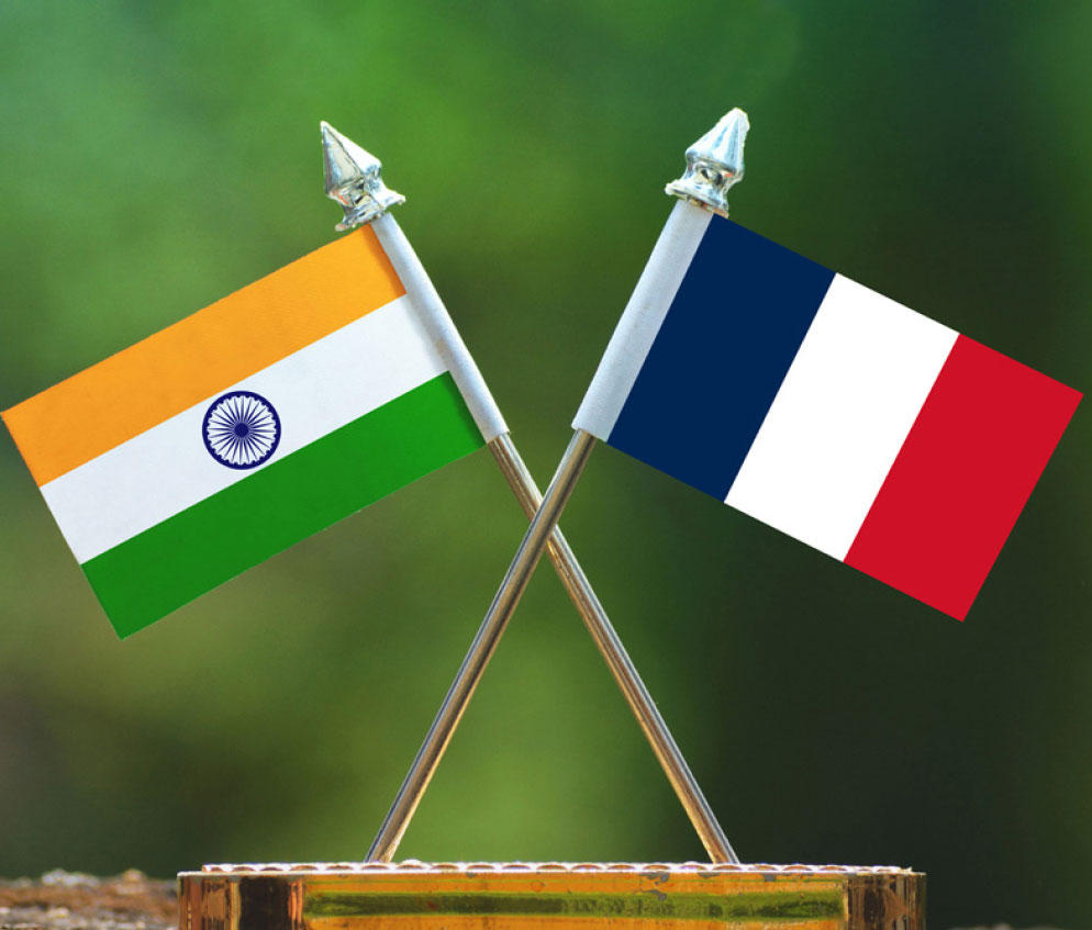
The inaugural Indian Space and Geospatial Industry Trade Mission to France, organised by GWCC, marks a significant milestone in the India-France collaboration in space and geospatial technology. This achievement coincides with the 25th anniversary of our strategic partnership and the recent adoption of the Horizon 2047 roadmap by both countries’ leaders.
The Horizon 2047 roadmap underscores the strategic importance of space and geospatial cooperation and digital infrastructure development in our respective nations. The rapidly advancing Indian and French geospatial and space sectors offer lucrative opportunities for collaboration between companies from both nations.
Speakers and Delegates
Tushar Phadnis
Counsellor (Space) and ISRO Technical Liason Officer
Embassy of India, Paris
"As Euroconsult President since 2004. he has been focused on the continuous expansion of the group, which has now over 1,200 clients in 60 countries and on the strengthening of its position as a leader in consulting for decision-makers in the space ecosystem. The multifaceted group now offers a unique portfolio of world-class services including strategy consulting, technology consulting, market intelligence, and executive events. In his 20 years working in the sector, He further had the privilege and opportunity to lead and contribute to over two hundred strategic consulting mandates for clients based across the globe including Europe, the US, the Middle East, Latin America, Africa, and a dozen Asian countries. Those mandates were conducted for government ministries and agencies, industry players, operators, investors, and other corporate organizations. He has the honor to be a regular speaker at a breadth of international events and has been a lecturer for several MBA and other academic programs dedicated to the space industry. "

Pacôme Révillon
CEO
Euroconsult
"As Euroconsult President since 2004. he has been focused on the continuous expansion of the group, which has now over 1,200 clients in 60 countries and on the strengthening of its position as a leader in consulting for decision-makers in the space ecosystem. The multifaceted group now offers a unique portfolio of world-class services including strategy consulting, technology consulting, market intelligence, and executive events. In his 20 years working in the sector, He further had the privilege and opportunity to lead and contribute to over two hundred strategic consulting mandates for clients based across the globe including Europe, the US, the Middle East, Latin America, Africa, and a dozen Asian countries. Those mandates were conducted for government ministries and agencies, industry players, operators, investors, and other corporate organizations. He has the honor to be a regular speaker at a breadth of international events and has been a lecturer for several MBA and other academic programs dedicated to the space industry. "

nicolas paparoditis
Deputy General Director
IGN-France
"Nicolas Paparoditis is a senior research scientist and Professor, currently Director of Research and Higher Education at IGN, the French national mapping and forest inventory agency, and the head of ENSG-Geomatique, the French engineering school of Geoinformation, and vice-president of University Gustave Eiffel. He was previously Chief Science Officer of IGN from 2014 to 2016. Before that he headed the MATIS laboratory of IGN from 2009 to 2014. He started his career in the Industry working as a research engineer for Aerospatiale (the French Aerospace company) from 1992 to 1997. He has also been the officer in charge of the programme “Digital Models” at the French National Research Agency from 2010 to 2012. Nicolas Paparoditis is a specialist of photogrammetric computer vision based data collection systems especially for 3D collection and city modelling. He has supervised 20 Phds and has published over hundred and fifty papers in the field of remote sensing, photogrammetry, and spatial information sciences. He has also leaded several large national research projects and also innovation projects around the development of technologies for 3D data collection and geovisualisation (Stereopolis and iTowns). Nicolas Paparoditis has been the XXIV ISPRS congress director in the period 2016-2022, a member of ISAC in the period 2012-2016, and the President of the ISPRS Commission III “Photogrammetric Computer Vision” in the period 2008-2012. He is a member of council of SFPT, the French Society of Photogrammery and Remote Sensing. Besides the XXIV ISPRS Congress, he organised several ISPRS worskshops, one ISPRS symposium, and chaired and organised the ISPRS Geospatial Week 2015 which was held in Montpellier, France. He is currently Vice-President of ISPRS for the period 2022-2026."
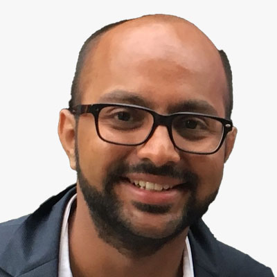
Akash Yalagach
CTO & Co- Founder
KaleidEO | SatSure
Akash Yalagach is currently the Chief Technology Officer at KaleidEO Space Systems Pvt. Ltd., a SatSure Company, where he is building a bridge between the upstream and downstream sector of the earth observation ecosystem with the team. He is a systems thinker and enjoys being at the intersection of technology and business to bring them together to create meaningful solutions. Earlier, he was at the Vikram Sarabhai Space Centre of the Indian Space Research Organisation (ISRO) for 7 years as a Mechanical Assembly, Integration and testing (AIT) engineer for all launch vehicles after completing his bachelor in aerospace engineering from the Indian Institute of Space Science & Technology. He was a part of AIT team for 22 launch vehicle missions of PSLV, GSLV and LVM3 at ISRO. He was a team member for the Crew Module Re-Entry Experiment launched on the maiden launch of LVM3 and also the launch team for the Chandrayaan-2 (2nd mission to the Moon by India). He was introduced to satellite engineering during his master's at the University of Surrey. He was awarded the Commonwealth Scholarship to pursue his master's. He is also currently pursuing his PhD in Deployable Spacecraft Mechanisms from the University of Auckland. Outside work, he enjoys playing a game of squash and going on a hike.
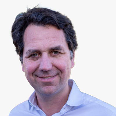
Ambriose Popper
Vice President
NextNav
"Vice President & General Manager at NextNav, a leader in resilient position, navigation & timing solutions, following the acquisition of Nestwave. Previously CEO of Nestwave, a provider of geolocation IP and cloud services for IoT modem makers. Background in Marketing, Strategy, and Business Development for the wireless, IoT and AI fields, with Silicon Valley + France background. Prior to that, was in charge of strategy, corporate marketing and business development at Quantenna, a leading high-performance WiFi chipset supplier that was acquired by ON semi (NASDAQ: ON). Started as co-founder and then general manager of IoT business at Sequans, a 4G chipset vendor."
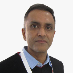
Avinash Viswanathan
Senior Vice President, Sales and Marketing
DSM Soft (P) Ltd.
Avinash is a Civil Engineer and a GIS professional. He has been with DSM Soft for 23 years and has served across various business functions within the organisation. Currently, he heads the sales and marketing function of DSM Soft, and manages key customer accounts worldwide. Avinash brings hands-on and all-round experience in data processing, software development and business development in promoting services and products of DSM Soft.
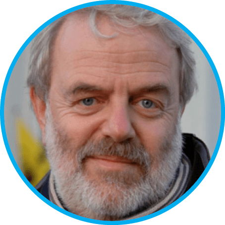
Francois Robida
Consultant
François Robida is a mining engineer and geostatistician and has 25 years of experience in computer science applications to earth sciences with BRGM (French Geological Survey). Following his first work in mining Geostatistics, he has been in charge of the design and development of software and programs related to all aspects of geology, and especially to 3D modelling. He was then been responsible for the BRGM software group, a team coordinating the development and marketing of software developed by BRGM. In his current position, he is in charge of the R&D and of the European projects in the domain of Information Systems for BRGM. As ""Terre Virtuelle"" project leader (Terre Virtuelle / Virtual Earth is a BRGM R&D corporate project to support the development of new services through the use of new technologies), François has been promoting and has introduced interoperability, Grid and Virtual Reality technologies within national geological survey. Involved as an actor of the development of interoperability at different levels, he is a member of the European Expert Group for INSPIRE (the initiative of the European Commission to develop European Spatial Data Infrastructure), where he represents the European geological surveys association (EuroGeosurveys). As representative of BRGM in OGC (Open Geospatial Consortium), he is also a member of the OGCEurope advisory board, and member of ADAE-CNIG (French counsel for geographic information) working group for geospatial interoperability.

Jean-Baptiste Monnier
Vice President and CFO
Asia Centre
As a software industry executive, he had the unique privilege to develop Bentley Systems, Inc (NASDAQ:BSY) products and Asia operations. Bentley’s mission is to enable engineers and architects, constructors and owner-operators to accelerate project delivery and improve asset performance for the infrastructure that sustains our economy and our environment. Working with super talented colleagues and highly professional users around the world has been a blessing. In early 2021, joined Asia Centre, the leading French think-tank on Asia geopolitics, working with to a team of world class researchers on geopolitical, energy and finance and economics.

Julien Chevalier
Area Manager of India
Kineis
Julien CHEVALIER is a professional in the defense and space industry. He is currently Area Manager MEA and Business Line Manager Defense at KINEIS. Prior to this, he held the positions of Business Manager of Defense & Security and Business Development Manager at CLS. Graduated from the business school in Bordeaux and the Saint-Cyr Coëtquidan Military Academy, Julien CHEVALIER has a solid background and extensive expertise in his field. He is recognized for his strategic insight, dedication and contributions to the growth and success of KINEIS and its previous organizations.
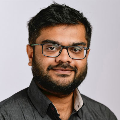
RUPAK DEORE
Geospatial World Consulting & Geospatial World Chamber of Commerce
Thriving in the jungle of entrepreneurship. R&D inertial navigation and GNSS engineer, with more than 5 years experiences R&D project, Product development and pre-sale post-sale customer support, in an international context.

Rupesh Kumar
Co- Founder
Suhora Technologies
With a knack for Software Architecture, Rupesh has over 17+ years of experience in developing solutions for areas as wide as Defence & Intelligence, Disaster Management, Natural Resource Monitoring, Environment & Weather, Smart Cities, and Homeland Securities.

Saurabh Rai
CEO
Arhas Technologies
Scaling a start to realise the great potential of Geospatial & AI Tech in India, Saurabh Rai contributes as a thought leader, and an experienced advisor on GIS, Geospatial technology, process initiatives, data science, data architectures, data engineering, Artificial Intelligence, Machine Learning, technology, analytics, user experience, data-driven businesses, customer success, and consumer insights. He possesses strong entrepreneurial, digital, analytical, and cross-industry skills and has led some of the largest Geospatial surveys, and systems deployment across the globe. The projects have won multiple awards including the first Edison award in India. A career built on a passion for Startups and Innovation; he has incubated Greenfield businesses, set up practices, and seen them through growth. Saurabh is passionate about Artificial Intelligence, Machine Learning, and related technologies in solving problems and bringing automation and efficiency to complex workflows. As Arahas Technologies' CEO, he turned the company into a major player in Geospatial Data and AI in India, focusing on Land, Water, Forest, and city services. He also led the Global Analytics and Geospatial divisions at Tech Mahindra. Notably, he launched India's first true B2B2C e-commerce platform, connecting partners and merchants across 15 states and also drove the start up operations to over USD 10 MN and GMV of 50 MN. Beyond that, he was also the member of global leadership team and he played crucial roles in Accenture, overseeing a USD 4 billion Utilities Business and contributing to Accenture Digital. He transformed GIS operations for big players like TATAPower, global utilities, telecom companies, and Smart Cities. He also led the GIS initiative for Mumbai Airport's modernization. In the finance sector, he incubated a a leading blockchain-based fintech company, focusing on cross-border payments and fundraising.

Soumya Misra
CEO
Sisir Radar
Building SISIR Radar - a company that indigenously develops cutting edge SAR, GPR, radars and remote sensing technologies. Built the world’s highest resolution L-band SAR mounted on a drone and a high bandwidth GPR with 20m ground penetration and 5cm resolution. Working on X-band SAR, custom drones, hyperspectral imager on drones and a SAR satellite constellation. Built Summachar - a news platform that aims to change the way news is created and consumed. Summachar presents news that matters in succinct infographics - data driven stories that go beyond headlines and opinions and visually explain what's in the news and its context. 100k+ readers. An avid problem solver and alumnus of IIT Kanpur with experience in engineering, graphic design, story-telling and product management across MNCs and startups. Previously built GPUs at Intel and indigenously designed and developed a smartphone at Creo.
Vinay Simha
CEO
Skyserve
Dr. Sethu Saveda Suvanam is the founder and CEO of ReOrbit, a Finland-based company with the mission of designing the next generation of MEO and GEO small satellites. Educated in India and Sweden, Sethu Saveda Suvanam is an aerospace engineer. He holds a PhD in Aerospace Engineering from KTH Royal Institute of Technology in Stockholm, Sweden. In November 2019, he founded ReOrbit with the aim of changing the way satellites are designed and used. ReOrbit develops satellites that are reconfigurable, scalable for different missions, and equipped with autonomous orbital capabilities.
Speakers and Delegates

Pacôme Révillon
CEO
Euroconsult
"As Euroconsult President since 2004. he has been focused on the continuous expansion of the group, which has now over 1,200 clients in 60 countries and on the strengthening of its position as a leader in consulting for decision-makers in the space ecosystem. The multifaceted group now offers a unique portfolio of world-class services including strategy consulting, technology consulting, market intelligence, and executive events. In his 20 years working in the sector, He further had the privilege and opportunity to lead and contribute to over two hundred strategic consulting mandates for clients based across the globe including Europe, the US, the Middle East, Latin America, Africa, and a dozen Asian countries. Those mandates were conducted for government ministries and agencies, industry players, operators, investors, and other corporate organizations. He has the honor to be a regular speaker at a breadth of international events and has been a lecturer for several MBA and other academic programs dedicated to the space industry. "

nicolas paparoditis
Deputy General Director
IGN-France
"Nicolas Paparoditis is a senior research scientist and Professor, currently Director of Research and Higher Education at IGN, the French national mapping and forest inventory agency, and the head of ENSG-Geomatique, the French engineering school of Geoinformation, and vice-president of University Gustave Eiffel. He was previously Chief Science Officer of IGN from 2014 to 2016. Before that he headed the MATIS laboratory of IGN from 2009 to 2014. He started his career in the Industry working as a research engineer for Aerospatiale (the French Aerospace company) from 1992 to 1997. He has also been the officer in charge of the programme “Digital Models” at the French National Research Agency from 2010 to 2012. Nicolas Paparoditis is a specialist of photogrammetric computer vision based data collection systems especially for 3D collection and city modelling. He has supervised 20 Phds and has published over hundred and fifty papers in the field of remote sensing, photogrammetry, and spatial information sciences. He has also leaded several large national research projects and also innovation projects around the development of technologies for 3D data collection and geovisualisation (Stereopolis and iTowns). Nicolas Paparoditis has been the XXIV ISPRS congress director in the period 2016-2022, a member of ISAC in the period 2012-2016, and the President of the ISPRS Commission III “Photogrammetric Computer Vision” in the period 2008-2012. He is a member of council of SFPT, the French Society of Photogrammery and Remote Sensing. Besides the XXIV ISPRS Congress, he organised several ISPRS worskshops, one ISPRS symposium, and chaired and organised the ISPRS Geospatial Week 2015 which was held in Montpellier, France. He is currently Vice-President of ISPRS for the period 2022-2026."

Ambroise Popper
Vice President & General Manager NextNav
"Vice President & General Manager at NextNav, a leader in resilient position, navigation & timing solutions, following the acquisition of Nestwave. Previously CEO of Nestwave, a provider of geolocation IP and cloud services for IoT modem makers. Background in Marketing, Strategy, and Business Development for the wireless, IoT and AI fields, with Silicon Valley + France background. Prior to that, was in charge of strategy, corporate marketing and business development at Quantenna, a leading high-performance WiFi chipset supplier that was acquired by ON semi (NASDAQ: ON). Started as co-founder and then general manager of IoT business at Sequans, a 4G chipset vendor."
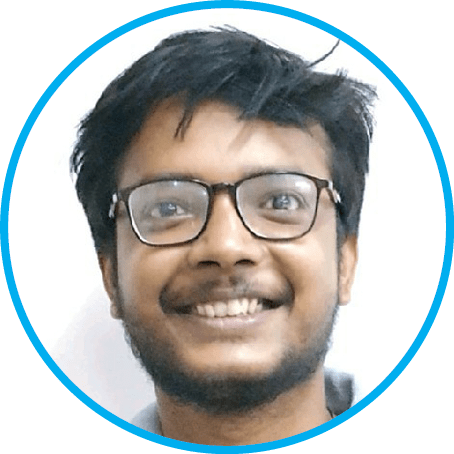
Rajan Srivastav
Founder & CEO
HELIWARE
"Founder & CEO of Heliware - 3D GeoSpatial Big Data Stack. Geospatial World 50 Rising Stars'22. Young Entrepreneur Award'21 by Indian Achievers' Forum . Part of MIT Technology Review global panel. Specialties: Leadership, Startups, Turn-Around, Finding Talent, Product Development."

Philippe Baptiste
Chairman and CEO
The CNES*
"Born in 1972, Philippe Baptiste holds a PhD from the University of Technology of Compiègne (UTC) and is a graduate in civil engineering from the Ecole des Mines engineering school in Nancy. He also holds an MSc from the University of Strathclyde, Glasgow, a DEA postgraduate diploma from Sorbonne University and is an accredited research director. A scientist from the digital sphere, Philippe Baptiste is a specialist in algorithms, combinatorial optimization, operational research and artificial intelligence. During the course of his academic career he has been a researcher at the French national scientific research centre CNRS (1999) and IBM’s Watson Research Center (2000-2001), and a lecturer at France’s prestigious Ecole Polytechnique engineering school (2002-2012). He is the author of several books and some 150 scientific publications and communications. He headed the Ecole Polytechnique’s information technology laboratory and created the Institute of Information Sciences and Interactions before being appointed Associate Director General in 2014 of CNRS, a key CNES partner. He also previously sat on the board of INRIA, the French national institute for research in computer science and control. Alongside his academic career, Philippe Baptiste has also helped to found and develop several start-ups and pursued numerous collaborations with digital, aviation and defence manufacturers. He was Chief Scientific Officer and then Chief Technology Officer of Total (2016-2017) and a Partner and Director with Boston Consulting Group (2020). From May 2017 to April 2019, he was chief of staff to Frédérique Vidal, the Minister for Higher Education, Research and Innovation, and in November 2019 advisor to the Prime Minister, Édouard Philippe. Throughout this period he was in close touch with space policy."

Digvijay Singh
National Manager, Geospatial Solution & System Integration
NeoGeoInfo Technologies Pvt Ltd
"Result oriented professional with over 10 plus years of experience in Geographic Information Systems (GIS) for various Projects & application systems. Extensive Expertise in designing, integrating and developing GIS data-sets & databases from available resources using ESRI Enterprise, ArcGIS, with help of maps, satellite imagery, GPS and D-GPS Data. Well versed with evaluating & reviewing the processes and providing the corrective and preventive actions based on the different Analysis. Effective Senior Team Leader and project trainer. Specialization » Continuously Operating Reference Stations(CORS), Positional Data, » Drone, LiDAR Surveys and Data Processing » GIS Projects Delivery and Business generation » GIS Data Analysing using Spatial Analyst, Network Analyst, ArcFM Tools, ArcGIS Pro » Creating, publishing and managing ArcGIS server Mapservice » GIS Server & Application Monitoring & operation management » GIS Workflow, Model Building, cartography data design » All Type of GIS Data Creation and on desktop or Server level using ESRI Products » GIS Map Creation, editing, updating and leading a team of Cartographers » System Integration Process and Automation testing » ArcGIS Server and Desktop Installation, Configurations and support » Business analysis requirement gathering and processing » D-GPS, GPS and ETS survey and survey project management » GIS Data Migration to ArcSDE/ArcGIS Server » Data conversion and maintenance » Data Analysis using ArcFM, ArcGIS and other GIS tools » Training Management & Trainer of R-APDRP » Knowledge of SQL queries, views, report construction » Navigation maps, POI and Road Network Digitization » Mapping and planning of GIS utility electrical network & consumer indexing » Geographic Information System, Domains Land based Creations Projects » Land base, Satellite Imagery, Toposheets & Image Geo-referencing using ESRI Products » Designing, Implementing and testing of System Integration Process » Developing GIS databases from available resources using ESRI Products, Auto CAD Map and OSGeo Products"

Francois Robida
Consultant
BRGM
"François Robida is a mining engineer and geostatistician and has 25 years of experience in computer science applications to earth sciences with BRGM (French Geological Survey). Following his first work in mining Geostatistics, he has been in charge of the design and development of software and programs related to all aspects of geology, and especially to 3D modelling. He was then been responsible for the BRGM software group, a team coordinating the development and marketing of software developed by BRGM. In his current position, he is in charge of the R&D and of the European projects in the domain of Information Systems for BRGM. As ""Terre Virtuelle"" project leader (Terre Virtuelle / Virtual Earth is a BRGM R&D corporate project to support the development of new services through the use of new technologies), François has been promoting and has introduced interoperability, Grid and Virtual Reality technologies within national geological survey. Involved as an actor of the development of interoperability at different levels, he is a member of the European Expert Group for INSPIRE (the initiative of the European Commission to develop European Spatial Data Infrastructure), where he represents the European geological surveys association (EuroGeosurveys). As representative of BRGM in OGC (Open Geospatial Consortium), he is also a member of the OGCEurope advisory board, and member of ADAE-CNIG (French counsel for geographic information) working group for geospatial interoperability."

Sean Wiid
CEO
UP42
Sean Wiid is the Chief Executive Officer of UP42. He has spent his whole career focused on geospatial technology and building digital mapping businesses. Prior to UP42, he was SVP of Platform and Content at Navico, where he ran the global map production operation and built the cloud platform team. At HERE Technologies and Nokia, Sean was responsible for strategy, business planning, and operations for the B2B business - helping to build and commercialize the HERE Location Platform. In previous roles at GDC (now part of Pitney Bowes) and Spatial Dimension (now part of Trimble), Sean worked as a software architect and lead developer building geospatial solutions for land administration, mining, and government. Seans strong technical foundation is underpinned by BSc and MSc degrees in Geomatics and Engineering, complemented with an MBA from the European School of Management and Technology (ESMT) in Berlin.

Saurabh Rai
CEO
Arahas Technologies
"Scaling a start to realise the great potential of Geospatial & AI Tech in India, Saurabh Rai contributes as a thought leader, and an experienced advisor on GIS, Geospatial technology, process initiatives, data science, data architectures, data engineering, Artificial Intelligence, Machine Learning, technology, analytics, user experience, data-driven businesses, customer success, and consumer insights. He possesses strong entrepreneurial, digital, analytical, and cross-industry skills and has led some of the largest Geospatial surveys, and systems deployment across the globe. The projects have won multiple awards including the first Edison award in India. A career built on a passion for Startups and Innovation; he has incubated Greenfield businesses, set up practices, and seen them through growth. Saurabh is passionate about Artificial Intelligence, Machine Learning, and related technologies in solving problems and bringing automation and efficiency to complex workflows. As Arahas Technologies' CEO, he turned the company into a major player in Geospatial Data and AI in India, focusing on Land, Water, Forest, and city services. He also led the Global Analytics and Geospatial divisions at Tech Mahindra. Notably, he launched India's first true B2B2C e-commerce platform, connecting partners and merchants across 15 states and also drove the start up operations to over USD 10 MN and GMV of 50 MN. Beyond that, he was also the member of global leadership team and he played crucial roles in Accenture, overseeing a USD 4 billion Utilities Business and contributing to Accenture Digital. He transformed GIS operations for big players like TATAPower, global utilities, telecom companies, and Smart Cities. He also led the GIS initiative for Mumbai Airport's modernization. In the finance sector, he incubated a a leading blockchain-based fintech company, focusing on cross-border payments and fundraising. "

Akash Yalagach
Chief Technology Officer
SatSure
Akash Yalagach is currently the Chief Technology Officer at KaleidEO Space Systems Pvt. Ltd., a SatSure Company, where he is building a bridge between the upstream and downstream sector of the earth observation ecosystem with the team. He is a systems thinker and enjoys being at the intersection of technology and business to bring them together to create meaningful solutions. Earlier, he was at the Vikram Sarabhai Space Centre of the Indian Space Research Organisation (ISRO) for 7 years as a Mechanical Assembly, Integration and testing (AIT) engineer for all launch vehicles after completing his bachelor in aerospace engineering from the Indian Institute of Space Science & Technology. He was a part of AIT team for 22 launch vehicle missions of PSLV, GSLV and LVM3 at ISRO. He was a team member for the Crew Module Re-Entry Experiment launched on the maiden launch of LVM3 and also the launch team for the Chandrayaan-2 (2nd mission to the Moon by India). He was introduced to satellite engineering during his master's at the University of Surrey. He was awarded the Commonwealth Scholarship to pursue his master's. He is also currently pursuing his PhD in Deployable Spacecraft Mechanisms from the University of Auckland. Outside work, he enjoys playing a game of squash and going on a hike.

Soumya Misra
CEO
Sisir Radar
"Building SISIR Radar - a company that indigenously develops cutting edge SAR, GPR, radars and remote sensing technologies. Built the world’s highest resolution L-band SAR mounted on a drone and a high bandwidth GPR with 20m ground penetration and 5cm resolution. Working on X-band SAR, custom drones, hyperspectral imager on drones and a SAR satellite constellation. Built Summachar - a news platform that aims to change the way news is created and consumed. Summachar presents news that matters in succinct infographics - data driven stories that go beyond headlines and opinions and visually explain what's in the news and its context. 100k+ readers. An avid problem solver and alumnus of IIT Kanpur with experience in engineering, graphic design, story-telling and product management across MNCs and startups. Previously built GPUs at Intel and indigenously designed and developed a smartphone at Creo. "
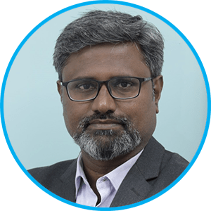
Pari Y
Associate Vice President & Head
GeoSpatial Technologies, Mindtree, L&T Group Company
Dr. Pari Y is an Associate Vice President & Head of GeoSpatial Technologies at Mindtree (A Larsen & Toubro Group Company). He has been practicing GeoSpatial Technologies for the past 23+ years with rich blend of both research and industrial experience. He has vast expertise in Advanced 3D Scanning Technologies, Global Navigation Satellite System, Digital Photogrammetry, Drone Applications, Spatial Analytics, Enterprise GIS, GeoSpatial Products & Platforms. He has received many national and international Awards for his extensive contribution in geospatial domain across AEC Industries. He is a well-known Key-note speaker in the Geospatial fraternity and has delivered more than 75 invited lectures in various conferences, corporate training programs, IITs, NITs, Universities & Colleges, State and Central Government department

Julien Chevalier
Area Manager MEA
Defense Business Line Manager
Julien CHEVALIER is a professional in the defense and space industry. He is currently Area Manager MEA and Business Line Manager Defense at KINEIS. Prior to this, he held the positions of Business Manager of Defense & Security and Business Development Manager at CLS. Graduated from the business school in Bordeaux and the Saint-Cyr Coëtquidan Military Academy, Julien CHEVALIER has a solid background and extensive expertise in his field. He is recognized for his strategic insight, dedication and contributions to the growth and success of KINEIS and its previous organizations.

Dhruva Space

Tech Mahindra
List of Participating Companies
| Name | Company Name |
|---|---|
Alice Guibert | Expertise France |
Ambriose Popper | NextNav |
Amèle Benamara | Gael Systems |
Antoine Lefebvre | Kermap |
Catalina Rodriguez | Aerospace Valley |
Felicien Roquet | Agence Française de Développement, AFD |
Francois Robida | Consultant |
Jean-Baptiste Monnier | Asia Centre |
Jerome Gilleron | MEOSS |
Julien Chevalier | Kineis |
Kammy BRUN | EO Industries |
Konrad Rolland | CLS Group |
Laure Fournier | YellowScan |
Laurent Geoffroy | FDC |
Laurent VELUT | Aerospace Valley |
Linda Tomasini | CNES |
Matthieu Taymans | Constellr |
Mayank Shankar Singh | Echo Analytics |
Mohamad Hamze | BWI- Blue Water Intelligence |
Nicolas Beaugendre | Kermap |
Nicolas Paparoditis | IGN- France |
Pacome Revillon | Euroconsult |
Paul Chambon | TERIA |
Paul Chambon | Teria |
Philippe Lattes | Expertise France |
Priyanka Rajkakti | Vortex-io |
Sylvie Teysseyre | Aerospace Valley |
Vishal Patil | Euroconsult |
Wandel DA ROCHA | Miratlas SAS |
and manymore…
TRADE MISSION FOCUS AREAS
Overview of Indian Space and Geospatial Industry
Overview of French Space and Geospatial Industry
Export Opportunities from India to France in Technology and Solutions
Export Opportunities from France to India in Technology and Products
Ease of doing business and facilitation by Governmentto- Government levels
PROGRAM OUTLINE
Day 1: 11th December
- India-France Space and Geospatial Business Summit and Networking Reception
Day 2: 12th December
- Visit to select Geospatial and Space companies and agencies
A comprehensive program outline will be provided to all participants.
For Programme & Registrations
Dr. Rajeshree Dutta Kumar
Vice President Programs and Partnerships, GWCC
Email: [email protected] | Mobile: +91 8800466890
Rupak Deore
Senior Research Manager – Space
Email: [email protected]


